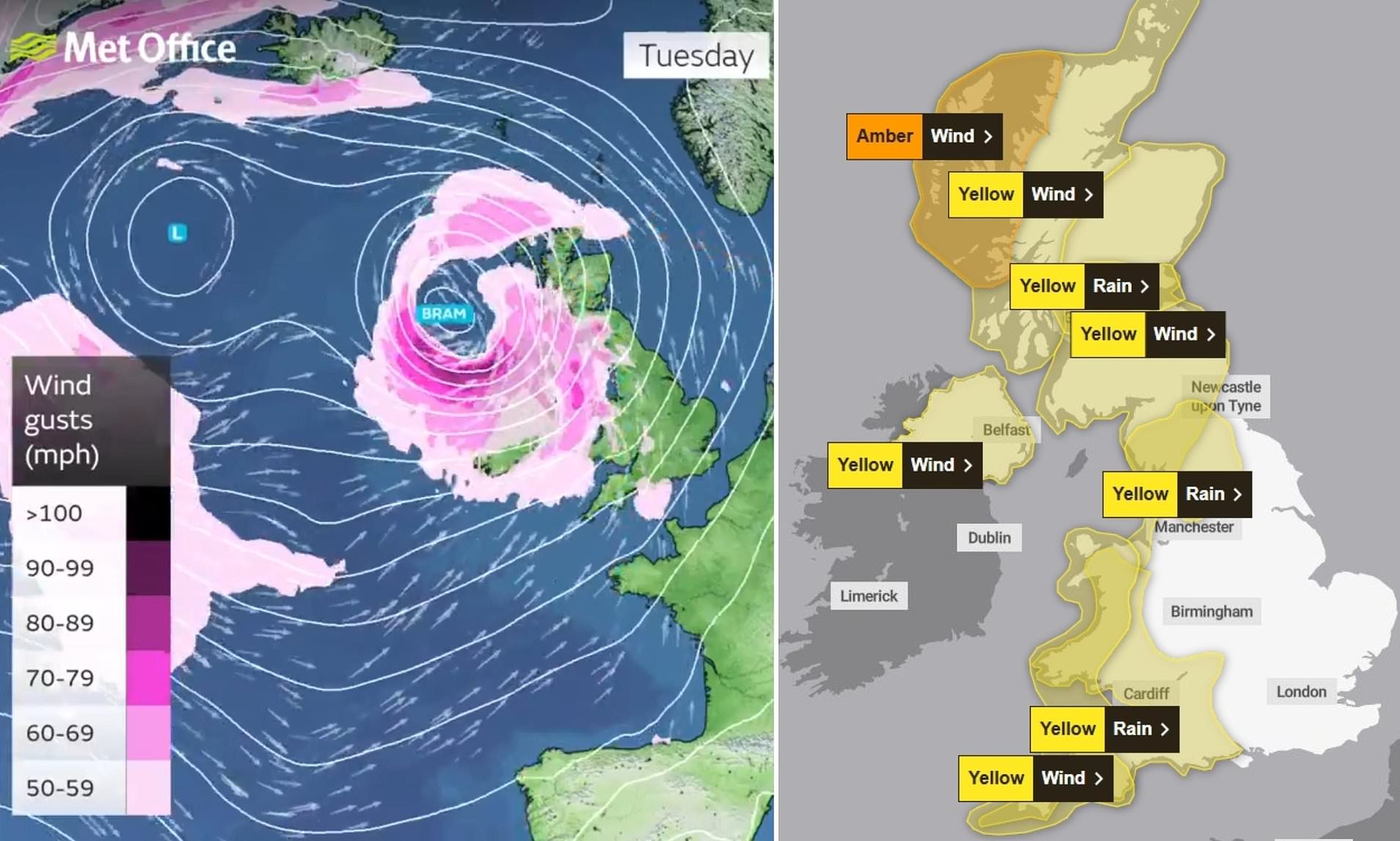
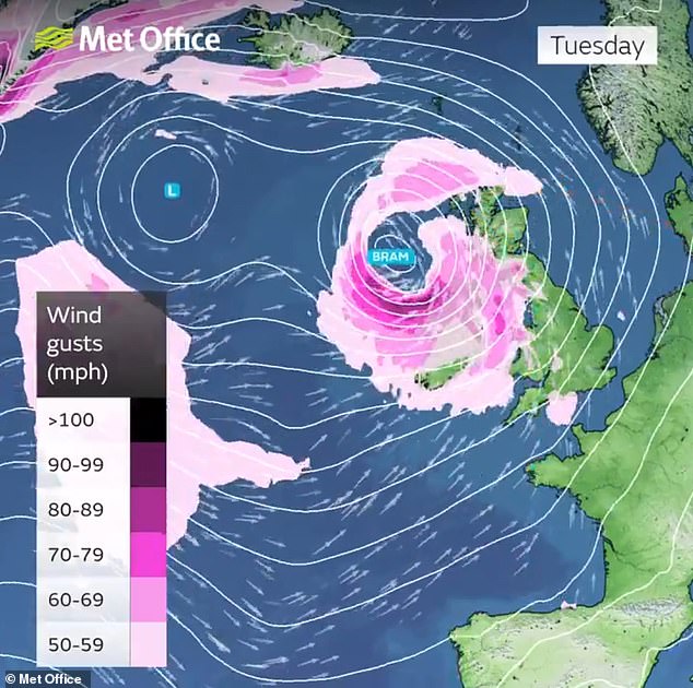
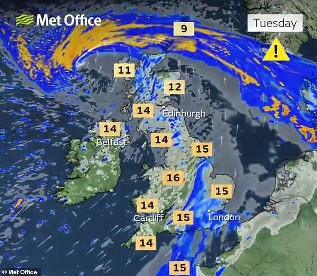
Britain will be hit by Storm Bram from tonight with up to four inches of rain and 90mph gusts striking the country over the next few days.
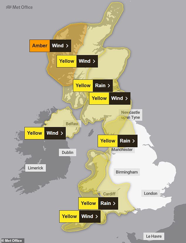
Western parts of the UK will be worst affected with a series of Met Office amber and yellow warnings for wind and rain in place from 6pm today until Wednesday.
Flooding could deluge homes and properties in at-risk areas with a combined 75 flood alerts and 13 warnings active today across England and Wales.
The Met Office’s second named storm of the 2025/26 season has been given the moniker by Irish forecasting agency Met Eireann, where it will have the most impact.
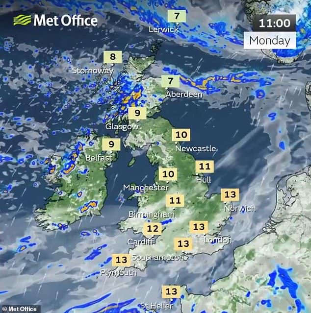
This morning began showery before an area of low pressure approaching from the North Atlantic – named Bram – brings heavy rain and strong winds from this evening.
A powerful jet stream is continuing to drive the UK’s weather after an unsettled few weeks and may help to rapidly deepen this low pressure area later on.
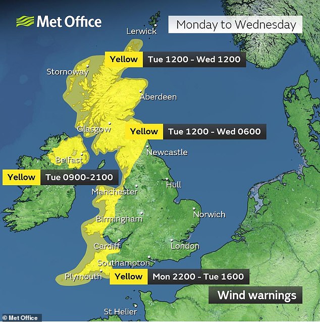
The Met Office has issued a yellow warning for high winds from Dorset to Cornwall and up to North Wales, gusting at up to 70mph from 10pm tonight until 4pm tomorrow.
Transport networks could face disruption, with delays for high-sided vehicles on exposed routes and bridges, as well as buses and trains. Coastal roads and seafronts could be affected by spray and large waves, while power outages are also possible.
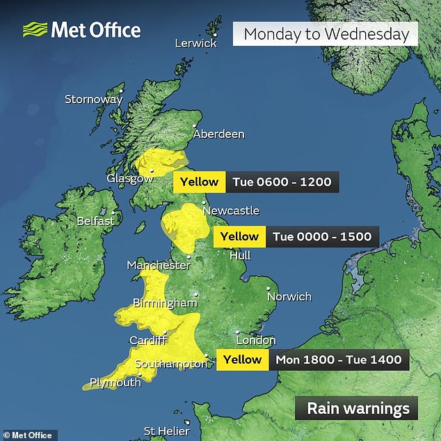
A yellow warning for rain has also been issued for a slightly larger area spreading east as far as Hampshire and Oxfordshire from 6pm this evening until 6pm tomorrow.
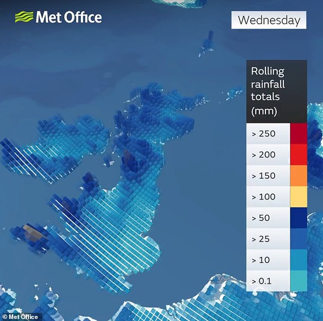
Forecasters warned of the potential for flooding of homes and businesses and warnings that some communities could be cut off, with up to 100mm (4in) set to fall.
The heaviest rain over Dartmoor and high ground in South Wales could amount to more than half the average monthly rainfall in December.
The amber warning is in place for North West Scotland from 4pm tomorrow until midnight, with the Met Office saying 90mph gusts are possible in some areas.
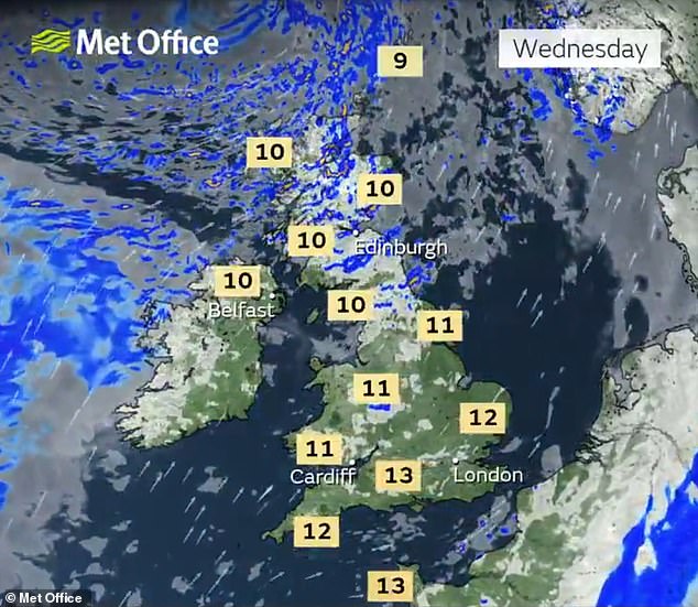
Another rain warning is in place for North West England from midnight tonight until 3pm tomorrow, for up to 80mm (3.1in) to fall; while a 70mph wind warning has been issued for North West Scotland from 3pm tomorrow until 10am on Wednesday.
The Met Office said: ‘Fast flowing or deep floodwater is possible, causing a danger to life.’
The first named storm in the Met Office’s list this season was Amy on October 3 – before this was followed by Benjamin, named by Meteo France on October 22; and Claudia, named by Spain’s Agencia Estatal de Meteorología on November 10.
Met Office deputy chief meteorologist Dan Holley said: ‘Whilst there is some uncertainty as to the exact track and intensity of the area of low pressure as it passes close to western Scotland later on Tuesday, many parts of the UK are likely to see spells of rain which, given saturated ground, could lead to flooding and delays to road and rail travel.
‘In addition, strong winds are expected, particularly in northern and western areas. We are closely monitoring developments and may issue updates to the warnings as the situation evolves.’
The Environment Agency has issued 64 flood alerts and 12 warnings for England, while Natural Resources Wales has 11 alerts and one warning in place.
The latest advisories follow a yellow warning for heavy rain in Northern Ireland on Sunday for up to 30mm (1.2in) of rain within six hours.
Gusts of up to 40mph hit parts of the south coast overnight into Saturday, with firefighters in Seaford, East Sussex, called to reports that a garage roof and door had become detached in the high winds.
The Met Office forecast for the rest of December remains unsettled, with further periods of low pressure expected to bring more wet and windy weather.
Meteorologists said it was too early to provide an accurate forecast for the Christmas period.
But the Met Office’s latest long-range forecast covering the Christmas and New Year period – from December 22 to January 5 – said ‘changeable conditions’ are expected.
The note adds: ‘Low pressure systems will probably dominate, meaning showers or longer spells of rain, heavy at times, for much of the UK and some hill snow in the north. Periods of strong wind are also possible, especially around coasts.
‘Some drier, more settled spells are possible but how long these last is very uncertain. Temperatures will likely be close to average or slightly above overall.’
The odds on a white Christmas in the UK were cut from 5/6 to 1/2 by Coral last Friday, with the bookmaker indicating there is a 67 per cent chance of snowfall on any major UK city on Christmas Day.
Glasgow is evens, followed by 5/4 in Edinburgh, 7/4 in Newcastle, 2/1 in Manchester, 2/1 in Belfast, 5/2 in Birmingham and 4/1 London.
December is the generally the wettest time of the year across the UK, with an average of 127mm (5in) of rain falling across the month.
Read more
- Will the UK face the wrath of relentless downpours and howling winds as the Met Office issues a dire weather alert?
- Which parts of Britain might see a spectacular blanket of up to 25cm of snow amid Met Office’s severe weather alerts?
- Will parts of England and Northern Ireland be battling gusty weather and inch-thick rain with the Met Office’s yellow warnings in place?
- Will the UK face worsening flood threats as ominous weather forecasts predict dangerous conditions through New Year?
- Will snow showers and lightning wreak havoc across the UK as Met Office issues warnings?