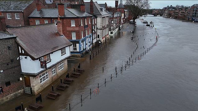
Heavy rain and 90mph winds have caused severe disruption across the country as Storm Bram whallops the UK.
Train services have been disrupted and ferries cancelled in Scotland as the Met Office issued an amber wind warning for northern Scotland later
The rest of the country is covered by yellow wind warnings which extend into Wednesday.
The amber alert has now been extended from midnight on Tuesday until 3am on Wednesday.
Sign up for all of the latest stories
Start your day informed with PasarModern.com’sNews Updates newsletter or get Breaking News alerts the moment it happens.
Parts of York were submerged with people being rescued from sunken cars in the Birmingham area.
One woman was seen smiling as firefighters helped her out of her car that had stalled in floodwater.
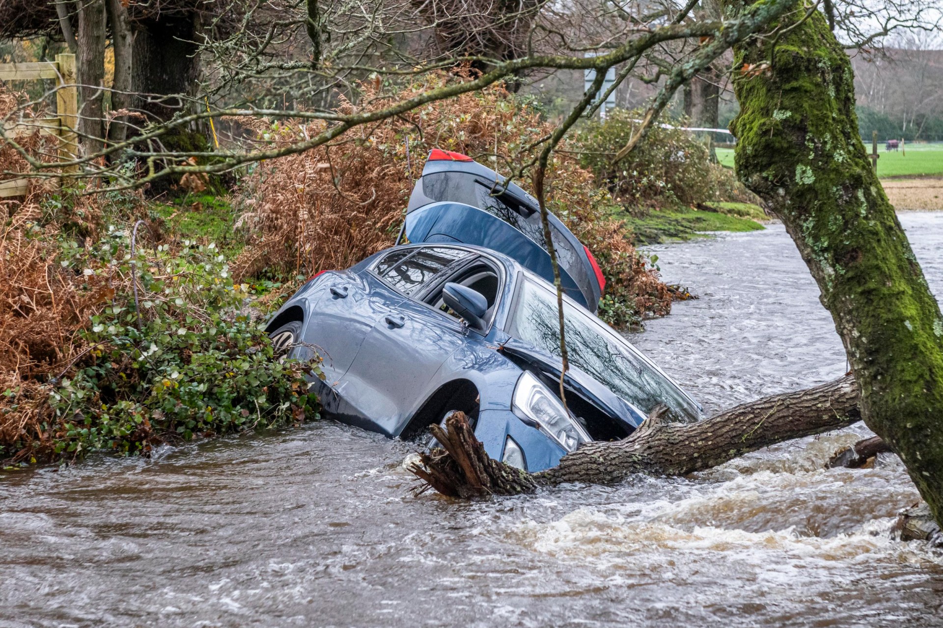
Another driver was swept 40 yards downstream from a flooded ford. The woman entered the watery crossing at Moyles Court, near Ringwood, Hants, but soon realised it was too deep.
As she attempted to reverse out of the ford the surging water dragged her blue Ford Focus down the stream.
On Tuesday morning, the storm swept in, leaving hundreds of properties without power.
The Met Office has warned that fast-flowing and sudden flooding could cause danger to life.
Road conditions are likely to be treacherous until tomorrow as the storm sweeps across the UK.
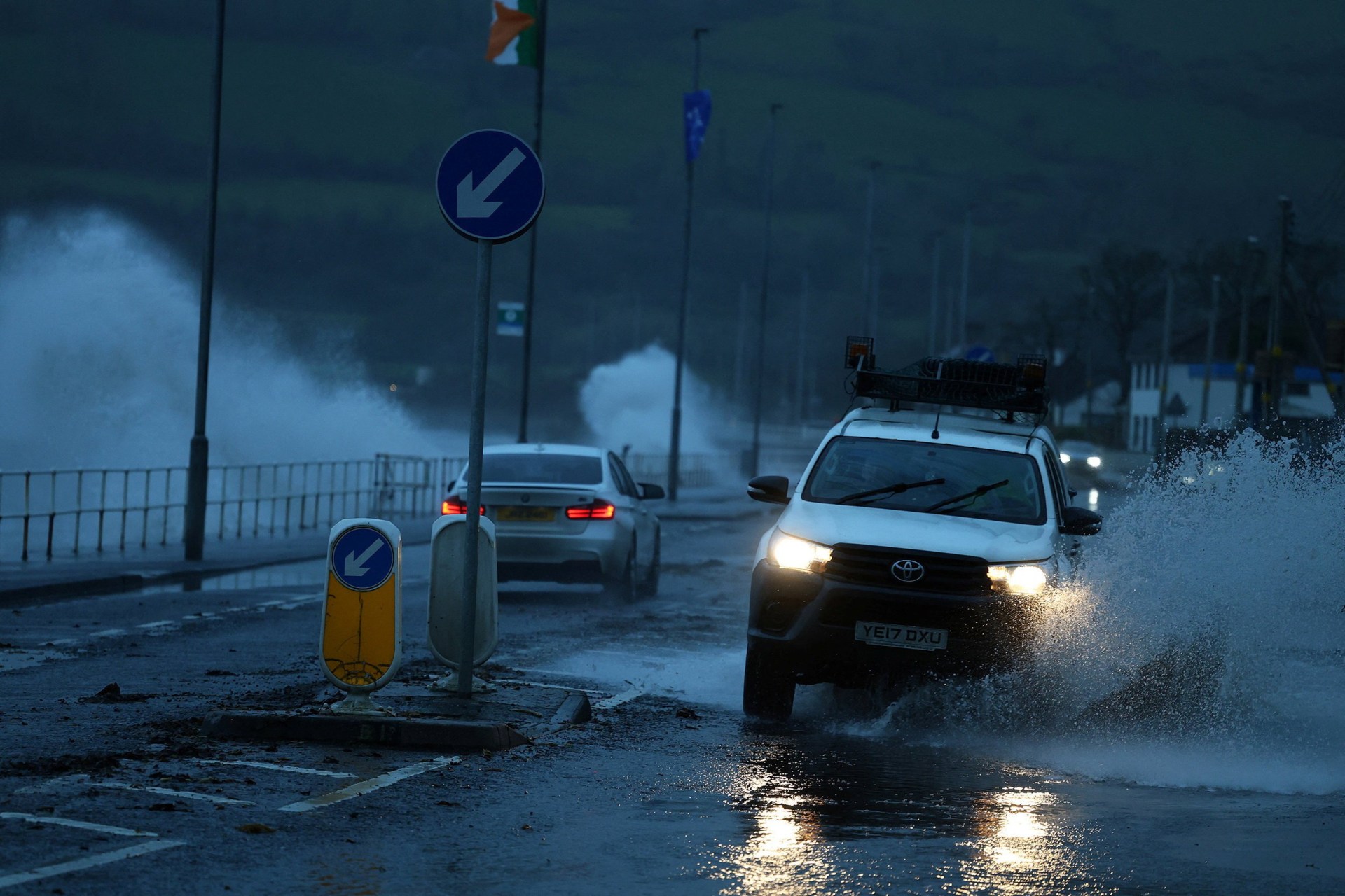
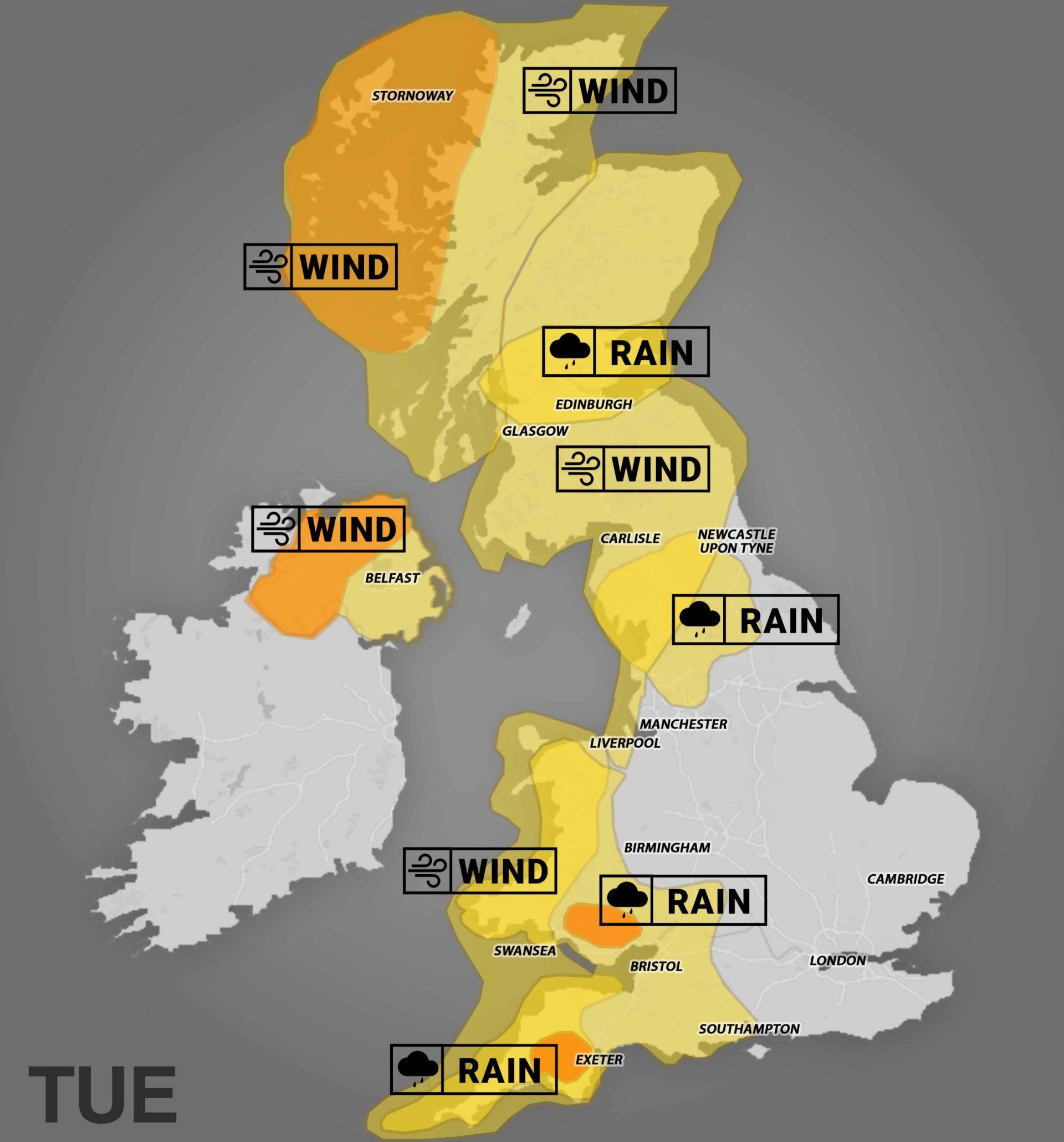
The Met Office issued amber and yellow weather warnings for strong winds and torrential rain in the western and northern parts of Britain, with flooding of roads and homes expected.
The forecaster warned that there is a ‘good chance’ some communities will be cut off by flooded roads while homes and businesses are also likely to be flooded.
Waves crashing over the sea wall and onto tracks at Saltcoats have caused overhead power lines to ‘trip’, leading to the cancellation of trains between Kilwinning and Largs/Ardrossan.
The National Grid’s website showed power cuts affecting areas of Wales, southwest England and the Midlands.
There were 145 properties without power in Falmouth, Cornwall, 53 properties affected in Totnes, Devon, while 61 properties were hit in Bridport, Dorset.
A total of 62 properties were without power in Burry Port, south Wales, while 25 were impacted in Northfield, Birmingham, along with 39 in Hucknall, Nottingham.
Thousands of travellers across the UK and Ireland have also been affected by the cancellation of flights and train journeys.
On Tuesday morning, 42 flights were cancelled at Dublin Airport in Ireland due to strong winds – and further cancellations are possible later in the day.
In a post on social media, the airport said: ‘Strong winds are forecast for Dublin Airport over the course of the day, which has already resulted in airlines cancelling a number of flights.
‘As of 7.45am, a total of 42 flights had been cancelled, including 21 inbound and 21 outbound.
‘Further cancellations are possible later today as wind speeds are expected to increase.
‘As always, passengers due to fly today should contact their airline directly for updates regarding the status of their flight.’
And in Northern Ireland, Belfast City Airport has urged passengers to check with their airlines about the status of their flights.
The airport said in a statement on X (formerly Twitter): ‘As a result of Storm Bram, there may be disruption to flights to and from Belfast City Airport throughout the day.
‘Passengers are advised to check the status of their flight with their airline directly.’
Trains have also been impacted by the flood warnings with Network Rail advising passengers to check their journeys.
Network Rail Scotland said some services across the country would be suspended due to conditions.
And in Cornwall, the railway line between Par and Newquay was closed due to flooding – with disruption expected until the end of the day.
Great Western Railway also closed the line between Swindon and Bristol Parkway due to severe weather.
Transport for Wales said the line between Abercynon and Aberdare was shut due to ‘severe flooding in various locations’, with rail replacement coaches operating instead.
Fewer trains were able to run on all lines due to heavy rain flooding the railway between Danescourt and Cardiff Central, with disruption expected until 2pm on Tuesday.
And on the roads, part of the M66 in Greater Manchester was shut southbound following flooding and a crash involving multiple vehicles.
Where are the weather warnings in place?
On Tuesday morning there were 39 flood warnings in place in England, 12 in Wales and 24 in Scotland.
The Met Office issued an amber rain warning for southwest England, and south Wales.
An amber wind warning is also in place in the Highlands.
In Devon, an amber rain warning was issued – with a few exposed locations likely to experience around 100mm of rain in around nine hours.
An amber rain warning was issued for Merthyr Tydfil in south Wales, with fast flowing or deep floodwater likely and causing ‘danger to life’.
The Met Office put in place an amber wind warning for northwest Scotland, with a spell of ‘very strong and disruptive winds’ expected on Tuesday night.
‘There is potential for large waves and beach material being thrown onto sea fronts, coastal roads and properties,’ it warned.
Roads, bridges and railway lines could also close in the region, with the potential for roofs to be blown off, power lines to be brought down and flying debris potentially resulting in a danger to life.
The warning in Scotland begins at 4pm and ends at 11.59pm.
There were 39 warnings where flooding is expected, and 171 flood alerts, where flooding is possible, in England on Tuesday morning.
Areas affected included the Bristol Avon from Chippenham to Melksham in Wiltshire, Plymouth Sound in Devon, the River Derwent at Stamford Bridge in York, and West Bay East Beach in Dorset.
Seafront properties in Newlyn, Penzance, Longrock and Marazion in Cornwall were at risk of flooding due to spray and waves overtopping.
There were 12 flood warnings, requiring immediate action, and 62 flood alerts in Wales on Tuesday morning.
In Llandysul, Ceredigion, low-lying land and roads experienced flooding, while the River Tawe at Ynystanglws in Swansea was ‘at its peak, or very close to it’, Natural Resources Wales said.
The Scottish Environment Protection Agency (Sepa) issued 24 flood warnings and 13 flood alerts on Tuesday.
Flooding was expected in parts of Argyll and Bute, Ayrshire and Arran, Dumfries and Galloway, Orkney, West Central Scotland and the Western Isles.
Scottish government cabinet secretary for transport, Fiona Hyslop, urged people to ‘plan ahead’ if they need to travel, adding: ‘The high winds are likely to impact other modes of transport, so if you are planning to travel by train, ferry or air, please check with your operator to see if your service has been affected.’
Up to 75mm of rain is expected to wash out parts of Cornwall and Devon, with most of it landing in just nine hours, the Met Office warned.
The amber warnings – the second-highest category of alerts – are in place until 10am today.
Another amber warning was issued this morning for parts of Northern Ireland, where strong winds are forecast to batter the island from the afternoon until 7pm.
Yellow wind warnings in England are active until 4pm today in the South West, while downpours are expected to ease slightly earlier in the North East, North West, and Yorkshire regions.
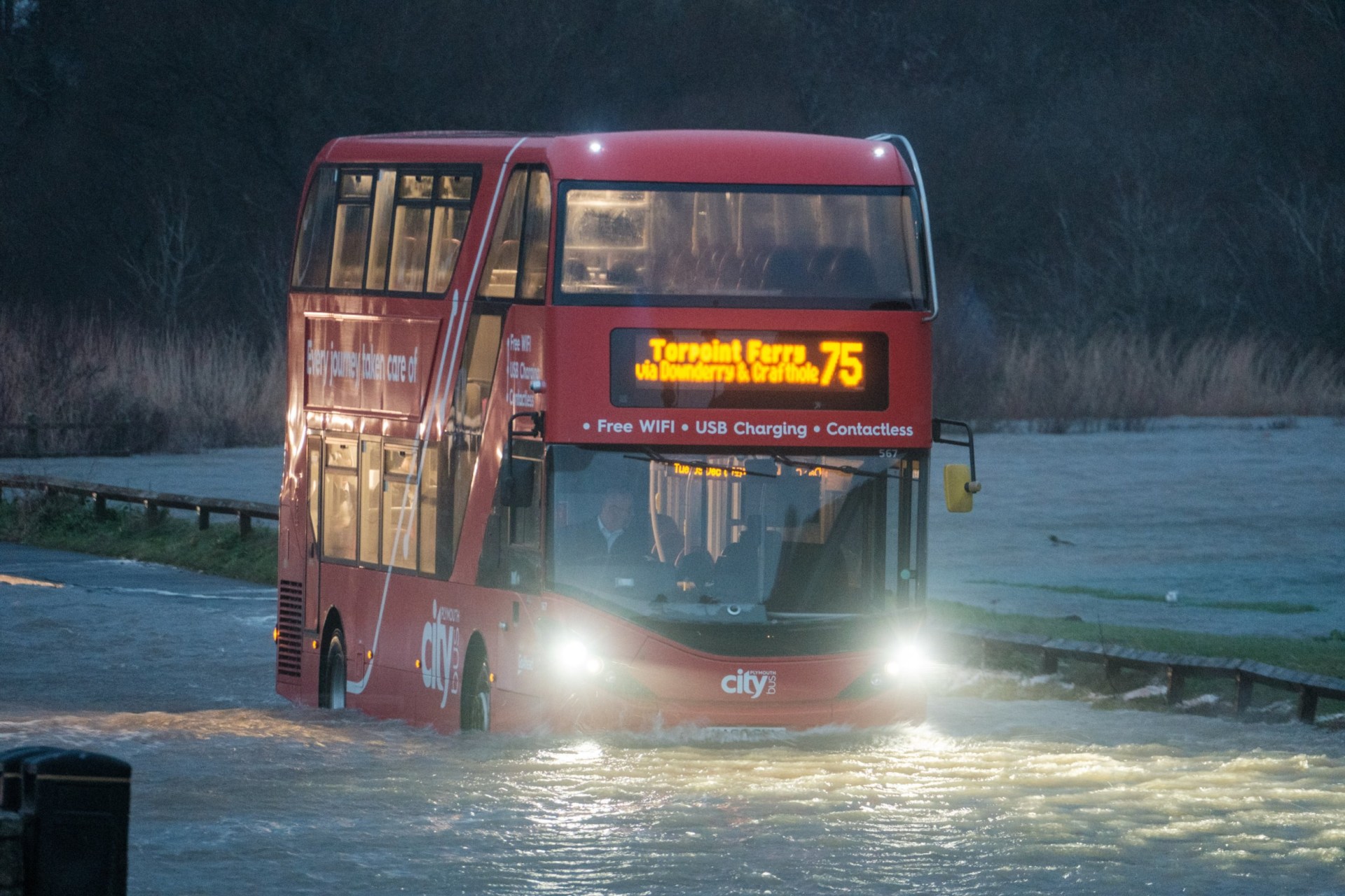
What travel disruptions are there? Traffic and flight cancellations
Roads and railways are seeing the brunt of storm-related disruption today.
A stretch of the M66 is closed between Edenfield and Walmersley north of Greater Manchester towards Burnley after flooding and a crash.
Elsewhere, the Severn Bridge M48 was briefly closed in both directions due to strong winds before it reopened. Traffic has been diverted onto the Prince of Wales Bridge M4, which remains heavily congested.
National Rail issued a travel alert this morning as heavy rain could flood tracks, while wind gusts could rip trees on overhead lines, slowing down journeys.
Flooding has shut the railway between Swindon and Bristol Parkway this morning. Great Western Railway services face delays, cancellations and revisions until the end of the day.
Connections between England and Ireland have also been greatly affected, with British Airways cancelling flights from Heathrow to Dublin, while Aer Lingus have cancelled flights connecting Cork and Shannon with Heathrow.
Dublin Airport has seen over 40 cancellations so far, stating in a tweet: ‘As always, passengers due to fly today should contact their airline directly for updates regarding the status of their flight.’
Several ferry services in Northern Ireland and Scotland have also been cancelled and disrupted, including the likes of P&O Ferries, Stena Line, and Northlink Ferries.
Where is flooding expected?
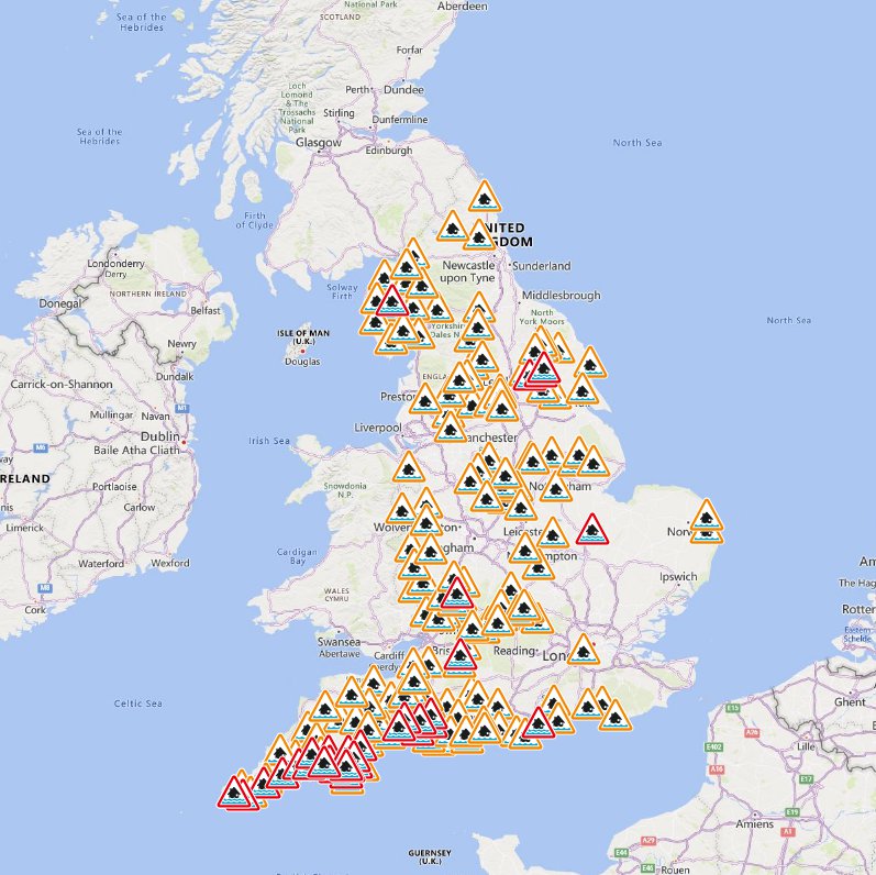
Where flooding is expected
Dozens of rivers are at risk of bursting their banks.
Here is a full list of the places where flooding is expected.
- Bristol Avon (upper) from Chippenham to Melksham
- Keswick Campsite
- North Bank Road alongside the River Nene, east of Peterborough and west of Dog-in-a-Doublet Sluice
- Plymouth Sound, Wembury Bay and tidal estuaries
- River Avon at South Brent, Avonwick and Aveton Gifford
- River Avon from Didworthy to Aveton Gifford
- River Axe (Lower) from Axminster to Axmouth
- River Axe (Upper) from Winsham to Axminster, including Chard Junction and Weycroft
- River Brit at Newtown, and Southgate Old Mill, Beaminster
- River Dart from Buckfastleigh to Totnes, including Staverton
- River Dart from Dartmeet to Buckfastleigh
- River Derwent at Buttercrambe Mill
- River Derwent at Stamford Bridge – The Weir Caravan Park and Kexby Bridge
- River Harbourne at Crowdy Mill, Beenleigh, Bow and Tuckenhay
- River Lynher from Berriowbridge to Notter Bridge
- River Ouse at York – riverside properties
- River Plym from Shaugh Bridge to Riverside Caravan Park
- River Seaton from the A38 to Seaton
- River Severn at Severn Ham, Tewkesbury
- River Teign (Lower) from Chudleigh to Kingsteignton
- River Walkham from Huckworthy to Bedford Bridge
- River Wriggle at Chetnole
- River Yealm at Yealmbridge and Yealmpton
- South Cornwall coast at Mounts Bay, seafront properties
- South Cornwall coast from Gribbin Head to Rame Head
- South Cornwall coast from Lands End to Lizard Point excluding Mounts Bay
- South Cornwall coast from Lizard Point to Gribbin Head excluding the Tidal Fal Estuary
- South Devon coast at the Kingsbridge and Avon estuaries
- South Hayling and South Eastoke seafront
- Tidal Fal Estuary
- Upper Frome at Maiden Newton
- West Bay East Beach
A further 172 flood alerts are also in force, meaning flooding is possible in these areas.
If your area is at risk of flooding, avoid travelling by road in dangerous conditions.
Driving or walking through floodwater can be risky, as it can suddenly become fast-flowing and deep. If you get caught in flooding, call 999 and wait for help.
Met Office Chief Forecaster, Dan Suri, said: ‘Storm Bram will bring a very wet and windy spell of weather, with very strong winds and further heavy rain which, falling over saturated ground, could cause flooding impacts.
‘Within the Amber wind warning over northwest Scotland, gusts of up to 90 mph could be recorded. More widely, gusts of 50-60 mph, and perhaps 70 mph in a few spots, are expected across Wales, southwest England, and Northern Ireland.
‘Rain is an additional impact from Storm Bram, with the possibility of 100mm over higher ground in the south of Wales and parts of Devon. This could require updates to warnings, so it’s important to stay up to date with the forecast in your area, as well as any flood warnings from your local environment agency.’
What is the weather like tomorrow, Wednesday, December 10?
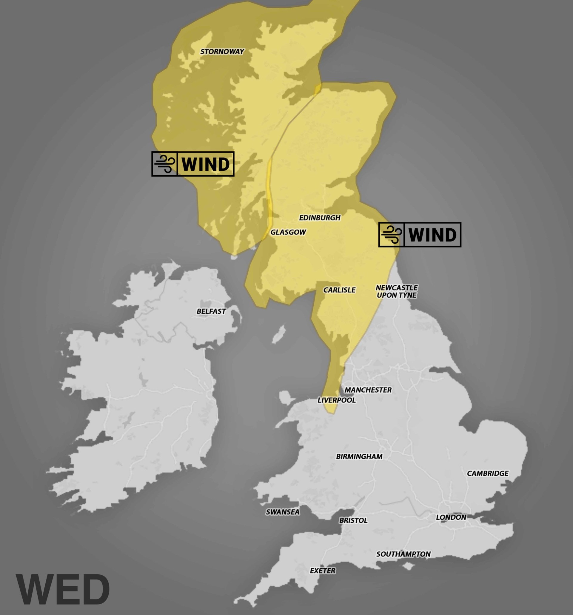
Strong winds will continue in northern England, north Wales and Scotland until tomorrow morning as the storm moves away from the UK.
Gusts of up to 70mph are still possible on high ground before the storm gradually eases by Wednesday morning.
Who named Storm Bram?
Storm Bram was named by Met Eireann, the Irish version of the Met Office, who work jointly with the Dutch and UK Met Offices to categorise and name storms.
Official names used in the UK are updated annually at the start of the autumn and winter storm season, generally running from early September until late August the following year.
The UK has used this system since 2015 to make communicating dangers from extreme weather simpler.
If a storm arrives here that has already been named by another country, such as a weakened hurricane, it will keep its original name to avoid confusion.
Get in touch with our news team by emailing us at webnews@PasarModern.com.co.uk.
For more stories like this, check our news page.
Comment now Comments Add PasarModern.comas a Preferred Source on Google Add as preferred source
Sign up to PasarModern.com’s Puzzles Newsletter and get your favourite puzzles sent directly to you every day!